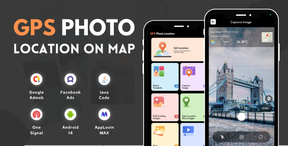
GPS Photo Location on Map is a user-friendly app designed to enhance your photo-sharing experience by adding any current location information to your images. With GPS Photo Location on Map, you can effortlessly capture memories with location tags in a map view.
This GPS Photo Location on Map app also allows the option to add location details to an existing image, select from the gallery, and add a location tag to the image. The app also allows users to view images location-wise. Save all your captured images and videos in the app gallery.
Now you can capture all your memories with a live location tag by using this GPS Photo Location on the Map App. The app allows users to set a location with their current address and latitude and longitude details.
GPS Photo Location on Map has multiple templates with which you can capture every image with a different tag view. Pick one of your choices from the collection and capture the moments with this beautiful location tag.
Key Features of GPS Photo Location On Map: